Chilkoot Trail
Klondike Gold Rush National Historical ParkDescription
Note from the webmaster: technically this is too far away from Anchorage (greater than a 4 hour car ride) to grant inclusion on this site but since many visitors to my site would be interested, it seemed appropriate to publish and have available.
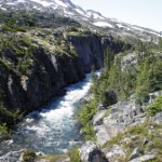
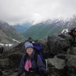
I hiked the Chilkoot with 3 other women June 27 - July 1, 2006. All of us are in pretty good condition and experienced backpackers. We did it in 5 days, four nights. It can be done in fewer days, but we like to be able to take our time and enjoy the journey. The availability of tent space at the established campgrounds along the trail also dictates your trip length; you can only camp in the established campgrounds, and must reserve your spaces in advance. This limits the number of people on the trail at any one time - which is a good thing. The first day took us 7.5 miles from the Dyea trailhead near Skagway to Canyon City Camp through coastal rain forest habitat. It was easy hiking with little elevation gain. The trail was very well-maintained with plank bridges over any creeks that couldn't easily be stepped across. Be prepared for rain - it's wet even if it isn't really raining, and it's hard to tell in a rainforest of large dripping hemlocks and spruce whether its raining or not. It makes for dozens of waterfalls, clear streams, fern-covered floors . . . beautiful. Canyon City Camp has a large old log cabin hikers can share to dry out, cook in, and warm up, and there are also bear lockers for storing food.
Day two took us another 7.5 miles (including a short side trip to see the actual ruins of Canyon City - not much there - it was a tent city) rising about 750 feet through more rain forest and into sub alpine terrain. Another pretty easy walking day. The views started opening up as we rose in elevation some. We camped the 2nd night at Sheep Camp - a really indispensable stop before you cross the summit the following day. Sheep Camp also has bear lockers and two canvas/log cabins for hikers to cook, dry out, etc. The US Ranger station is also located near Sheep Camp, and the ranger talks at 7:00 pm (AK time) each night to give an update on trail conditions up to and over the summit. He sets trail markers in the snow fields of the upper elevations on the AK side of the trail every day as conditions change - which they do daily. The Canadian Wardens set them on the Canadian side daily. He recommended we all be on the trail by 5:30 am (AK time) to be over the summit and starting down before noon so we wouldn't be postholing through rotten snow the following afternoon. Everyone took his advice.
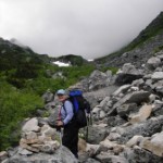
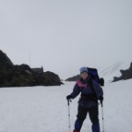
Day three was summit day. The trail rises about 3000 feet from Sheep Camp to the Chilkoot Pass in roughly 3.5 miles. The first 2.5 miles is called Long Hill: a steady uphill from sub alpine to alpine to boulder fields and snow fields. No more well-tended trail with plank bridges over creeks. It was snow melt and mud and left-over avalanches and snow bridges. I was thankful for water proof boots, neoprene socks, and hiking poles. And, oh yeah, it was awesomely spectacular scenery, too. The Long Hill ends at The Scales, where historically gold rushers had to weigh their gear for the Canadian Mounties. The Scales marks the grueling last mile to the summit - the "Golden Stairs". You've seen pictures of it in history books. A line of ant-people crawling up an incredibly steep snow-covered gully between towering peaks. Now imagine the snow is mostly melted, exposing the huge boulders, scree, loose rocks, and abandoned gear beneath. There's no actual trail up it. You just go up any way you can, climbing, crawling, pushing and pulling yourself up and up. Wear gloves, and, if you have any fear of heights, keep your eyes and mind focused ahead and above you.
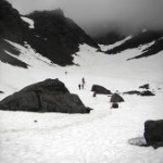
Arriving at the summit at top of the Golden Stairs, I couldn't keep the grin off of my face. It was plastered on like I was a lunatic. The summit is the US/Canadian border. A Canadian and US flag waves from the small warming hut just over the summit. By the time we got to the summit we were cold, wet, tired and exhilarated. Hot chocolate was just the thing to get us going again. From the summit until we reached Happy Camp about another 4 miles down trail, we were walking on mainly snow fields. This is why the early start in the day was necessary. The trail was well marked with flags and stone cairns and the views of Crater Lake and its surroundings below were extraordinary. At no time were snowshoes or other special winter gear necessary, although we were told that earlier in the season many hikers use snowshoes.
Happy Camp, the first camp on the Canadian side, is beautifully set along a rushing alpine river, but it was windy and cold. There was still snow on the ground, but there are raised wooden platforms to set tents on. Be sure your tent is free standing and has tie downs to keep it from blowing away. There is a very nice warming hut and 2 little sheds to store food in.
Day four was 8.5 miles of relatively easy hiking again - some periodic ups and downs but nothing like summit day. We got below snow line and the sun warmed things up right away. Neoprene sox came off very quickly. The trail was again easy to follow with bridges over all streams of any size. The trail passes stunning mountains, gorges, rapids, and aqua blue alpine lakes. It is well worth the work to get there! We stopped to check out Lindeman City (another ghost town) and get our official certificate from the Canadian Warden stating we'd crossed the pass, and then continued down trail to Bare Loon Lake Camp.
It was hot and sunny by the time we reached Bare Loon Lake and we were covered with 4 days of sweat, DEET and dirt - naturally we jumped in. It's a lovely little gem of a lake surrounded by smooth rock, sand and scrub pine. Again, the Canadians provide wooden platforms for your tents and a newly built gazebo-type structure with picnic tables in it for cooking in. Instead of bear lockers or sheds, there are poles to hang your food bags from. Be sure to bring rope.
Day 5 was a short, sunny, hot 4 miles over rocky and sandy ridges down to Bennett Lake and the official end of the Chilkoot Trail. Here the White Pass and Yukon Railroad will pick up hikers (Saturdays and Sundays only) and carry them back to Skagway. There is no road access to the end of the trail. You either take the train out, get a water taxi, or hike out the railroad right-of-way to the Highway at Log Cabin. We took the train out - it was another terrific experience all in itself. Especially since we have a friend who works on the train a and he met us with a cooler full of beer!
All in all, this was an absolutely wonderful trip. I've lived on the Kenai Peninsula for 18 years and hiked most of the trails in Southcentral AK, as well as many in the Fairbanks area, and this was one of the best outdoor experiences of my adult life (I'm 53). It takes a lot of advanced planning and time and it's a long ways from Anchorage, but if you can manage to work it into your summer - you'll be glad that you did.
Important Information
Waterproof boots and neoprene/waterproof socks were really necessary for the summit day. Be sure your rain gear is really waterproof and that your sleeping bag is warm enough - mine was a 20 degree bag, and two nights I wished I had packed my 0 degree bag, instead. Bring gloves, hat, warm fleece and extra socks. And a bathing suit if you're too shy to jump in Bare Loon Lake in your undies.
Bring an emergency kit. I seemed to be the only person with one on the trail and word spread. I used it 6 times for people not in my hiking group (duct tape was the most-asked-for item, followed by string, Band-Aids, moleskin, and antibiotic ointment).
Most hikers go from AK to Canada - we only met one group of hikers going the other way.
Etc.
You have to plan this trip well in advance. You must get trail passes and reserve campsites. That sounds like a pain, but it controls the number of people who use the trail, and is really a good thing. You also must have ID (passports preferably), if you are going on the train, because you cross the US/Canada border.
