Ptarmigan Peak
Chugach State ParkDescription
This is a great hard day hike for somebody in moderate shape who is not afraid of loose rock and scrambling. The book, 50 Hikes in Chugach State Park, gives good directions, but I will add some info:
First, I did this hike on a recent 75 degree August day, so it was hot (south exposure).
You start on Powerline Pass from Glen Alps - the first try, a few weeks earlier, I started on foot and was burned out by the busy, flat powerline trail for the first 3 miles. This time, I mountain biked to the "trailhead" (it is unmarked and not real clear - again I recommend the book over my directions). Eliminating 1-1/2 hours from the hike was a very nice deal. I stowed my bike in the bushes. The ride back is especially nice - almost all downhill.
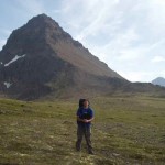
At the foot of a saddle to the west (right) of Ptarmigan Peak (a very steep looking, rocky, pyramid-like mass, the third (?) back from Flat Top - you should easily identify it as much more impressive than Flattop or the others between the two) you start out on steep tundra, with no switchbacks. Stay (as the book says) to the right of the saddle and the creek- this keeps you on the tundra trail instead of a steeper, rocky gully with loose scree.
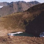
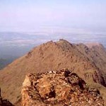
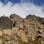
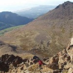
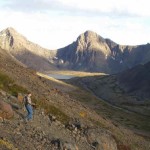
After a exhausting 3/4 miles up you reach Ptarmigan Pass (which I explored on the first trip and then decided it was to late to try the upper peak) The pass is great- a high, flat tundra plateau that first crosses above an easily accessible tarn lake. This looks down the Rabbit Creek Valley if you hike to its south side. Again, follow the books advice and traverse the tundra field to start the advance up to the upper peak along its southwest ridge. The "trail" starts mildly steep but quickly raises its grade, loses its definition, and becomes increasingly gullied and loose. Stay on the most well worn paths across the scree, on an eastward curve around the mountain as you head up- better steps are found in the dirt along this path than the loose rock on others. The last 1/4 mile is all gully crossing and boulder fields. the top is really large broken rocks, with many ankle-breakers. The top has two summits- one very peaked (on the west) the other more flat. One has a memorial that I believe honors a long time hiker who died falling on the rocky slopes.
Both summits had the same weird bug phenomena I have witnessed on almost every other Chugach peak I have climbed (except Flattop?). That is: the tallest spots have a major infestation of no-see-ums (or flying ants?) that make the stay very short lived. Descend 20 ft, no bugs! The view is still great, as long as you can stand the bugs- I managed a few photos and then headed a few feet lower. You can see Turnagain Arm and Rabbit Lake from the top. The trip down is slow and painful- lots of tricky gullies to appreciate anew as you go down on your rear end. From the ridge back down to Ptarmigan Pass is not bad, and still great views. The hike back down to Powerline Pass is relatively easy compared to the trip up- you can walk pretty quickly down the steep tundra. As a side note I am torn on this practice- it erodes the tundra, but the option is constant slips on loose gravel on the well worn portions. Since the state does not seem keen on (or can not afford to develop) switchbacks, they leave little choice but massive slope erosion of popular trails. However, that rant said, I think this peak is so under hiked that it is probably still okay to do the tundra crossing. There is not much of a choice in many places. Do the bike thing and this trail is great. The bike ride took 25 min. then 1.75 hours up, 1 hour down, 10 min bike ride back. the book says 5-8 hours, but this includes the long hikes along Powerline Pass to and from the actual trail up to the peak.
Important Information
- Not for young kids! 2) Only the best hiking dogs need attend - and it will be rough on their paws regardless. And 3) you are isolated - I saw only one other hiker on the upper peak, and only one on the hike from the Powerline Pass to Ptarmigan Pass, and this on a great August Saturday at 1pm. Let people know where you are going, especially if you are stashing a bike. Again, (see the O'Malley Peak description) kiss the Flattop crowds goodbye as you experience one of the closest real escapes into mountain solitude in the Anchorage foothills.
Etc.
The Glen Alps Parking Lot requires a $5 parking fee (bring exact amount). The price for an annual parking pass is $60. You can purchase a pass at the Federal Building at 4th and F or the Atwood Building on 7th and E, 13th Floor.
Here are the directions for getting there: take the Seward Highway to the O'Malley exit and head east. After a few miles, follow the signs to Glen Alps. Make a right on Hillside Drive then a left on Upper Huffman. Turn right on Toilsome Hill. This road will twist and wind up the hills for about two miles.
