T'Kishla Peak
Chugach State ParkDescription
Webmaster's Note: Rollin is remembering when he hiked this in 1972
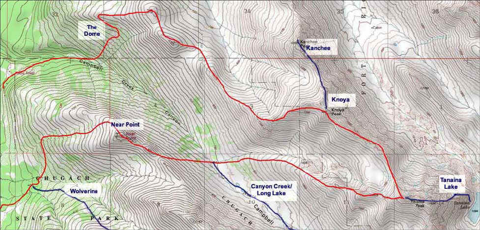
We drove to the Prospect Heights trail head from Elmendorf United States Air Force Base. Turn left under the powerlines and follow the old homesteader's trail into and down to the Middle fork of Campbell Creek. Ignore trails to the right and stop where the Wolverine Peak trail and the Near Point Trail diverge. Here we, David Henney and I, parked our VW that special day. Go over Near Point to the North Fork of Campbell Creek (I took a color side there of David Henney and the Valley and our goal which was published on the cover of the Alaska-Yukon section of the Alaska Magazine).
At the North Fork of Campbell Creek, you may want to snack and discuss the climb to the goal. Young and inexperienced, we chose to go directly up toward T'Kisla. Our progress was steady, unhurried and purposeful. The summit disappears at points.
We knew about this way only from Thirty Hikes in Alaska published in 1967 by The Mountaineers and Mountaineering Club of Alaska. The book describes the trail head accessed from Campbell Air Strip Road with a route over Near Point.
Our route stayed to the right on the slope to the top of the ridge. After a brief self congratulation we decided the T'Kishla summit was down and up again eastward on the ridge. From the ridge top the North side looked forbidding but we prudently avoided exposure. Our decision was correct. Standing on T'Kishla, we took numerous Kodachrome II slides which now deserve scanning into digital format.
There was early snow in the relief on the North slopes of O'Malley. It was wonderful to see Wolverine and Near Point from a new and higher view. The North Fork Lakes were in view up the valley as well as peaks unknown to us far to the East. Knik Arm was visible. A treat was a view of the meanders at the delta of Eagle River. A true surprise was discovering well known Alaskan signatures and comments in a rusty coffee can wedged beneath rocks at the top. We added our neophyte names to the list.
The higher view of Anchorage with crepuscular rays slanting through late afternoon scattered cloud is memorable. Descent was careful but rapid, staying again on the Campbell Creek side of the ridge. Scree was present but moved little when we crossed. We climbed out of the North Fork Valley at sunset.
Plan ahead, as we did not allow enough time for this all day hike. Overnight camp in the North Fork Valley would be more sensible. The Northern Lights were out. We went down and to the left where we knew the road and our car awaited. It was a great hike but better local knowledge and more careful planning could have minimized the worry near the end.
I detailed our experience, now almost 35 years old, just to communicate my enthusiasm for this route.
It was a day never to be forgotten. Please post your experience and up to date knowledge so I may follow your way next time.
Excellent 2 page (106 and 107) account of this Way to the Wilderness in 55 Ways to the Wilderness in southcentral Alaska by Helen Neinhauser and Nancy Simmerman. Second Edition.
Long ago I heard Walt Parker say, "Wilderness need not be far, it can be near". This hike is near but has a feel of wilderness.
Go now.
Important Information
T'Kishla is on military land. You will need to get a permit to hike there and let them know. Go here for more information.
Etc.
The Prospect Heights Parking Lot requires a $5 parking fee (bring exact amount). The price for an annual parking pass is $60. You can purchase a pass at the Federal Building at 4th and F or the Atwood Building on 7th and E, 13th Floor.

Finding the Trailhead
Hike Map